MAP OF MINING DISTRICTS SURROUNDING TOWNSITE IDAHO SPRINGS COLORADO by Theodore Lowe, 1881
$15,000.00
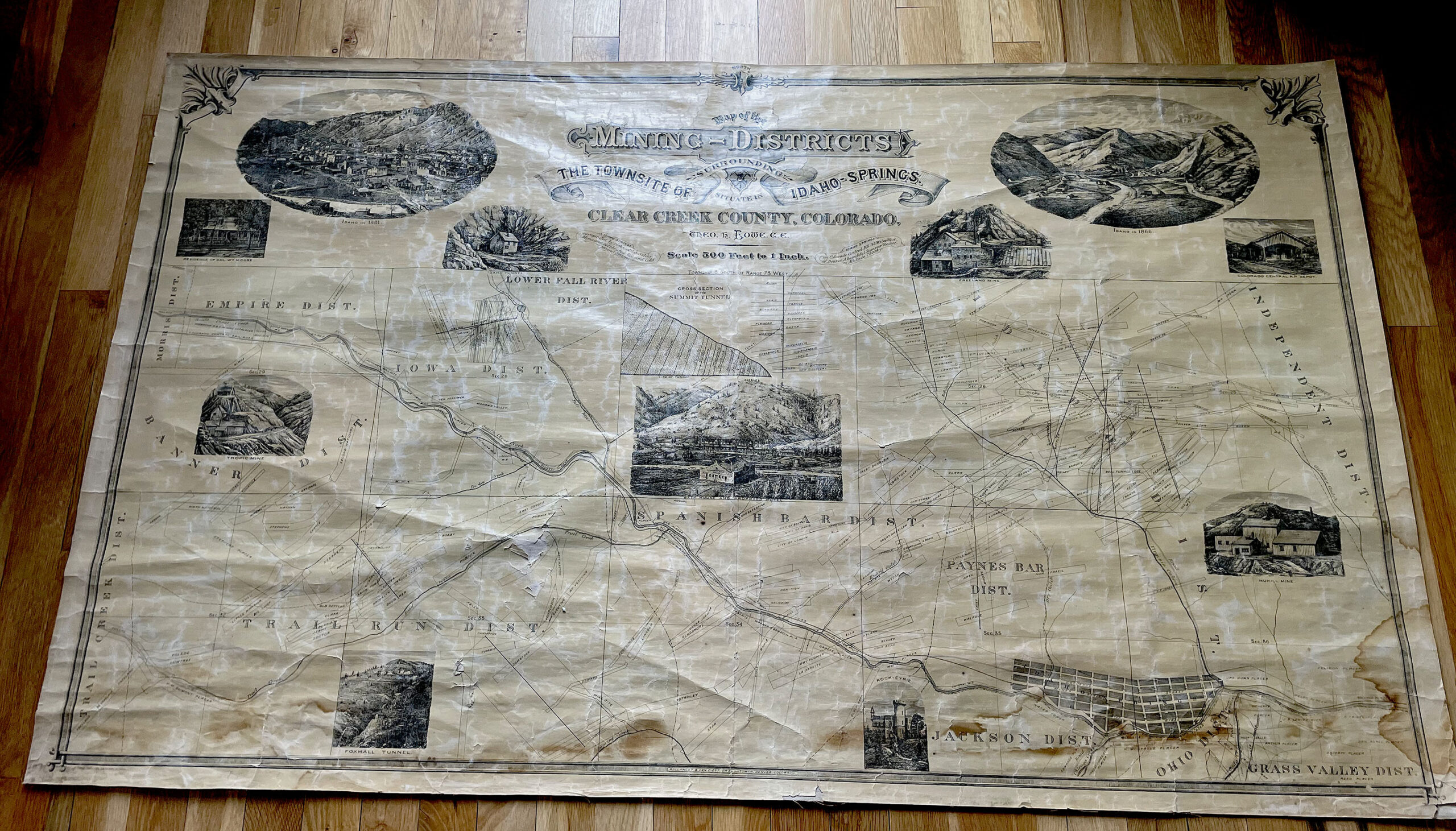
MAP OF THE MINING DISTRICTS SURROUNDING THE
TOWNSITE OF IDAHO SPRINGS, CLEAR CREEK
COUNTY, COLORADO, 1881
Description
MAP OF THE MINING DISTRICTS SURROUNDING THE
TOWNSITE OF IDAHO SPRINGS, CLEAR CREEK
COUNTY, COLORADO, 1881
Theodore H. Lowe, Civil Engineer
Rollandet & Van Diest, Draughtsmen, Denver, Colorado
Scale = 1 inch = 500 feet
Dimensions: 55 inches by 32-3/4 inches
Mining districts include, but not limited to: Morrison, Lower Fall River, Empire, Banner, Mill Creek, Trail Run, Spanish Bar, Paynes Bar, Jackson, etc.
Steel engravings include, but not limited to: Idaho Springs 1881, Idaho Springs 1866, Tropic Mine, Foxhall Tunnel, Rock-Eyrie Castle, Hukill Mine, Colorado Central Railroad Depot, Freeland Mine, etc. Map also exhibits Colorado Central Railroad Line, mining claims and mill sites, and topographic features.
Paper on original linen.
Condition: very good to very good plus; generally clean; a half-dollar place where paper is missing and paper exposed; otherwise, 98% complete, with little or no information missing; some light water-staining along lower two inches. Map has been removed from its original wood rollers; backed by original linen (1881); occasional spots of paper loss, however no significant information missing; original 1881 map glossing.
COLORADO ARTIFACTUAL