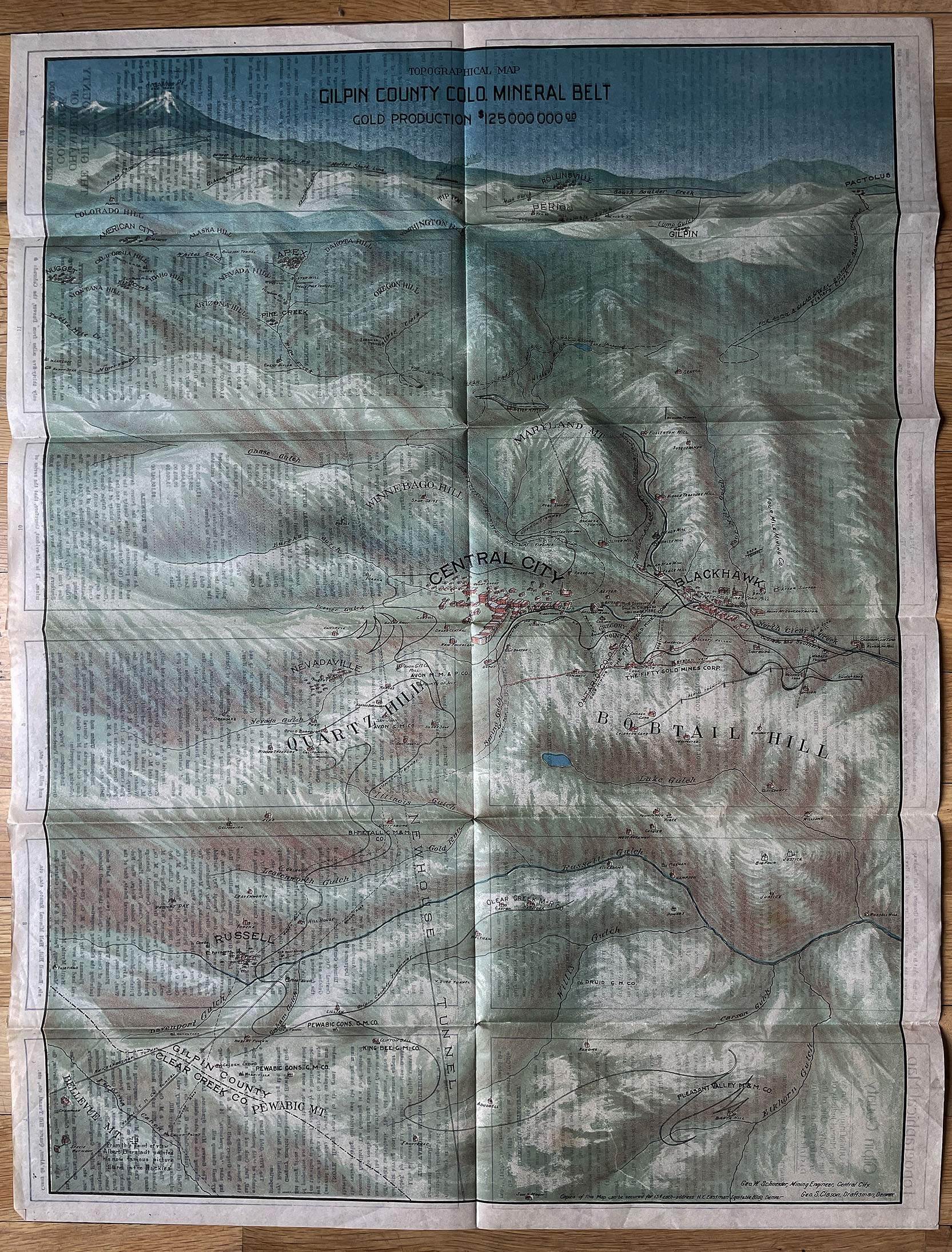


Topographical Map of Gilpin County Colorado Clason Mining Map 1906
$575.00
TOPOGRAPHICAL MAP OF CENTRAL CITY, COLORADO, 1906
Published by the Geo. S. Clason Company
COLORADO ARTIFACTUAL
Related products
-

MAP OF THE CITY AND COUNTY OF DENVER, COLORADO 1908
$675.00 -

GUNNISON COUNTY COLORADO Majestic Empire of Western Slope promotional book by A. P. Nelson 1916
$1,750.00 -
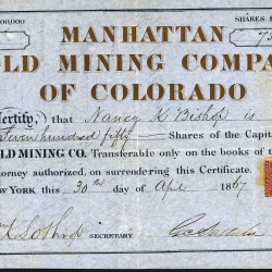
MANHATTAN GOLD MINING COMPANY OF COLORADO Territorial stock certificate Gilpin County 1867
$0.00 -

Rarus Warrior Mining Report Romley Chaffee County Colorado & Southern Railway photo stock certificate 1922
$0.00