Customer matched zone "United States (US)"
“MAP OF CRIPPLE CREEK MINING DISTRICT EL PASO COUNTY COLORADO 1893” has been added to your cart.
View cart
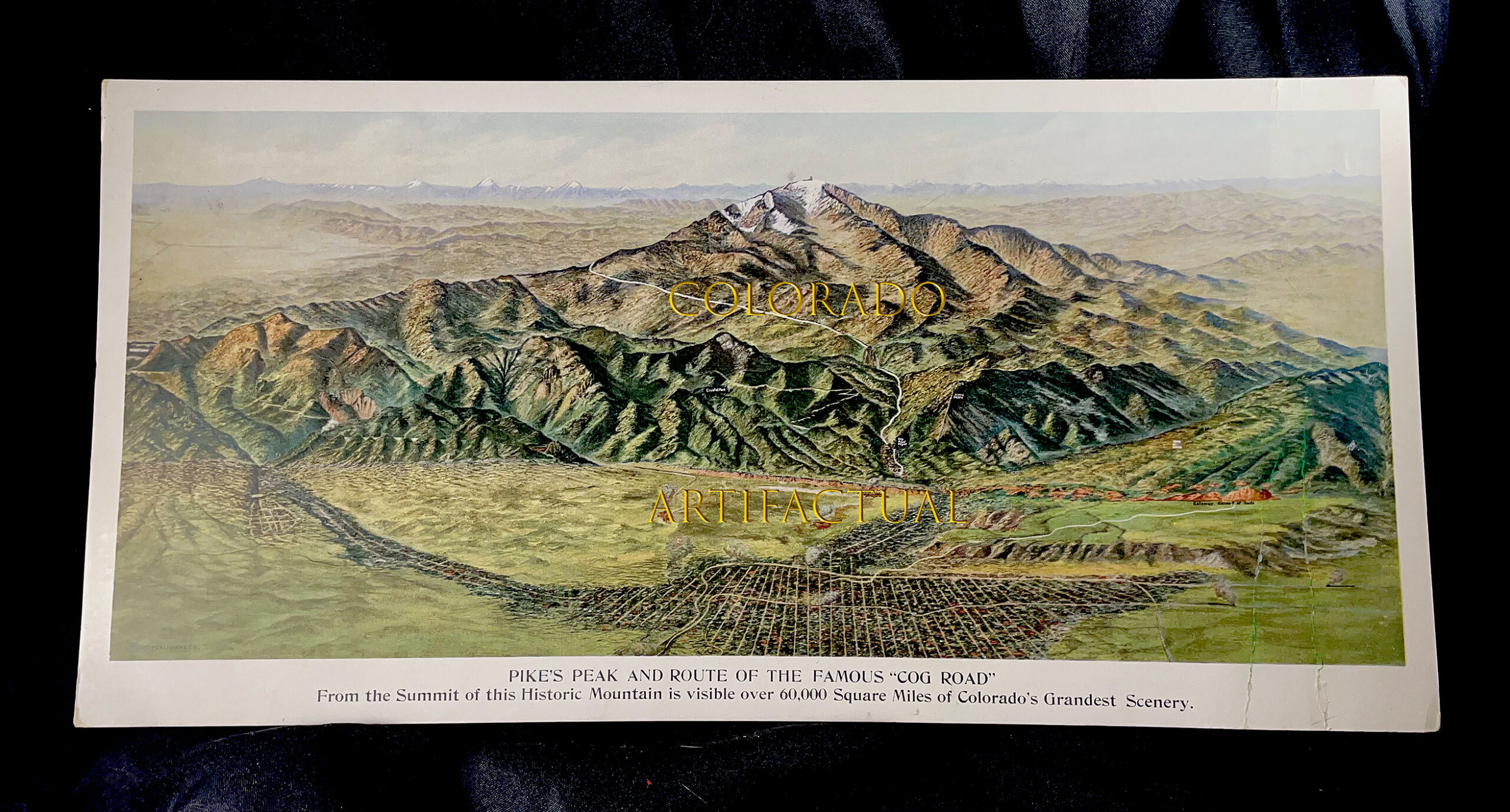
PIKES PEAK & COG ROAD bird’s-eye-view map Detroit Publishing lithograph 1910
$2,000.00
PIKES PEAK & COG ROAD bird’s-eye-view map,
Detroit Publishing lithograph 1910
COLORADO ARTIFACTUAL
Description
PIKE’S PEAK and ROUTE OF THE FAMOUS “COG ROAD”
From the Summit of this Historic Mountain is visible over 60,000 Square Miles of Colorado’s Grandest Scenery
Original Detroit Publishing lithograph, circa 1910
Scarce bird’s-eye-view perspective from the Company associated with photographer, WILLIAM HENRY JACKSON
Perspective shows Pikes Peak, Colorado Springs, Cheyenne Mountain, Manitou Springs, Penrose, Cog Road, Crystal Peak, and other Pikes Peak Region landmarks
Dimensions: 16-3/4 inches by 8-1/4 inches
Condition: very good plus to near fine; vivid colors; clean and bright; however, two thin creases on right-hand side of lithograph, one 4 inches long and the other 3 inches, somewhat visible but not a detraction.
COLORADO ARTIFACTUAL