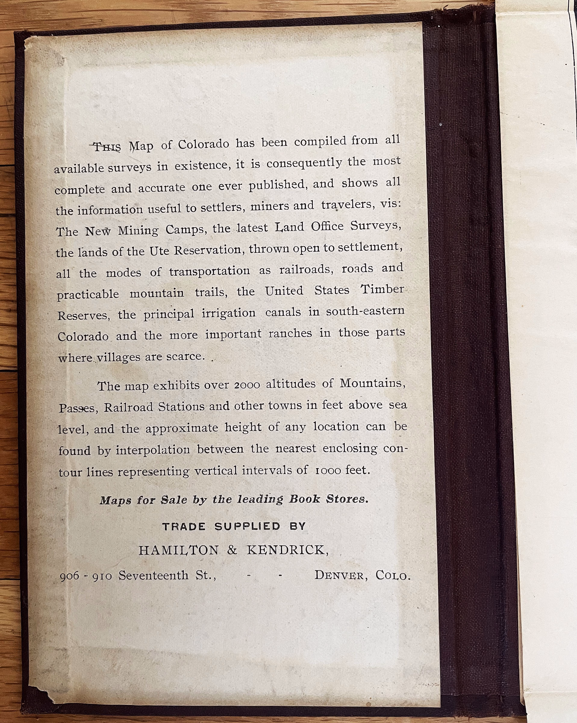
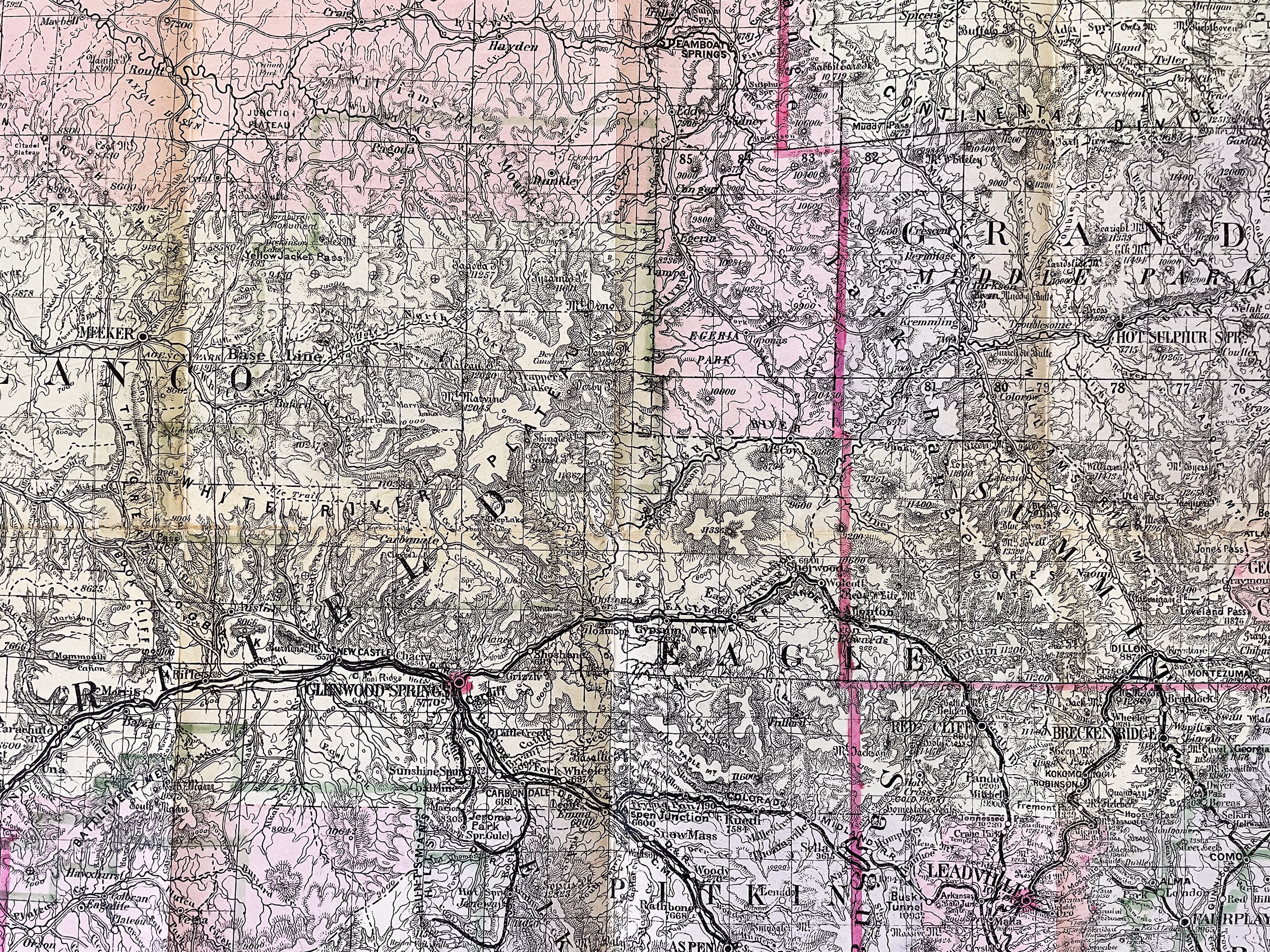
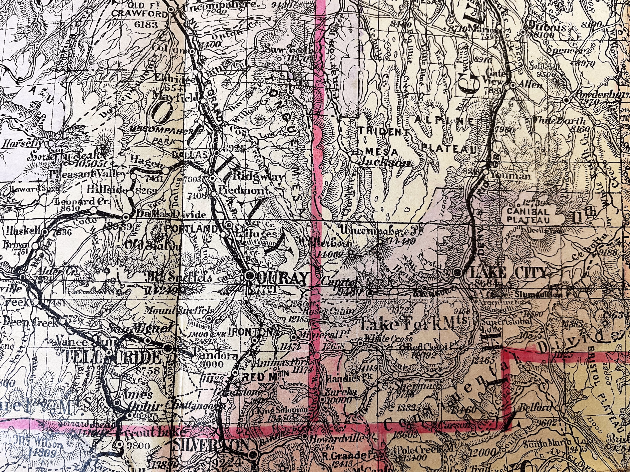
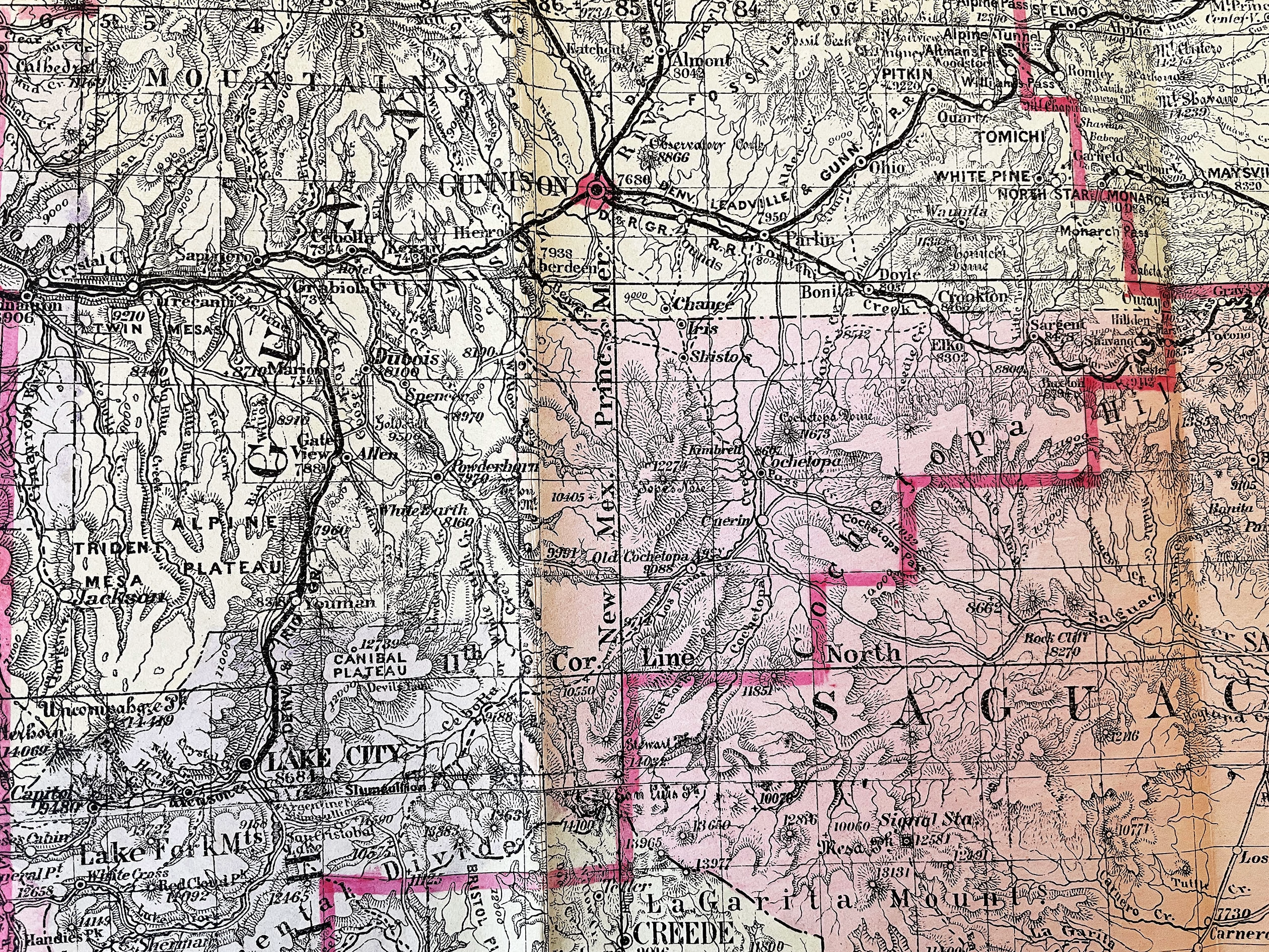
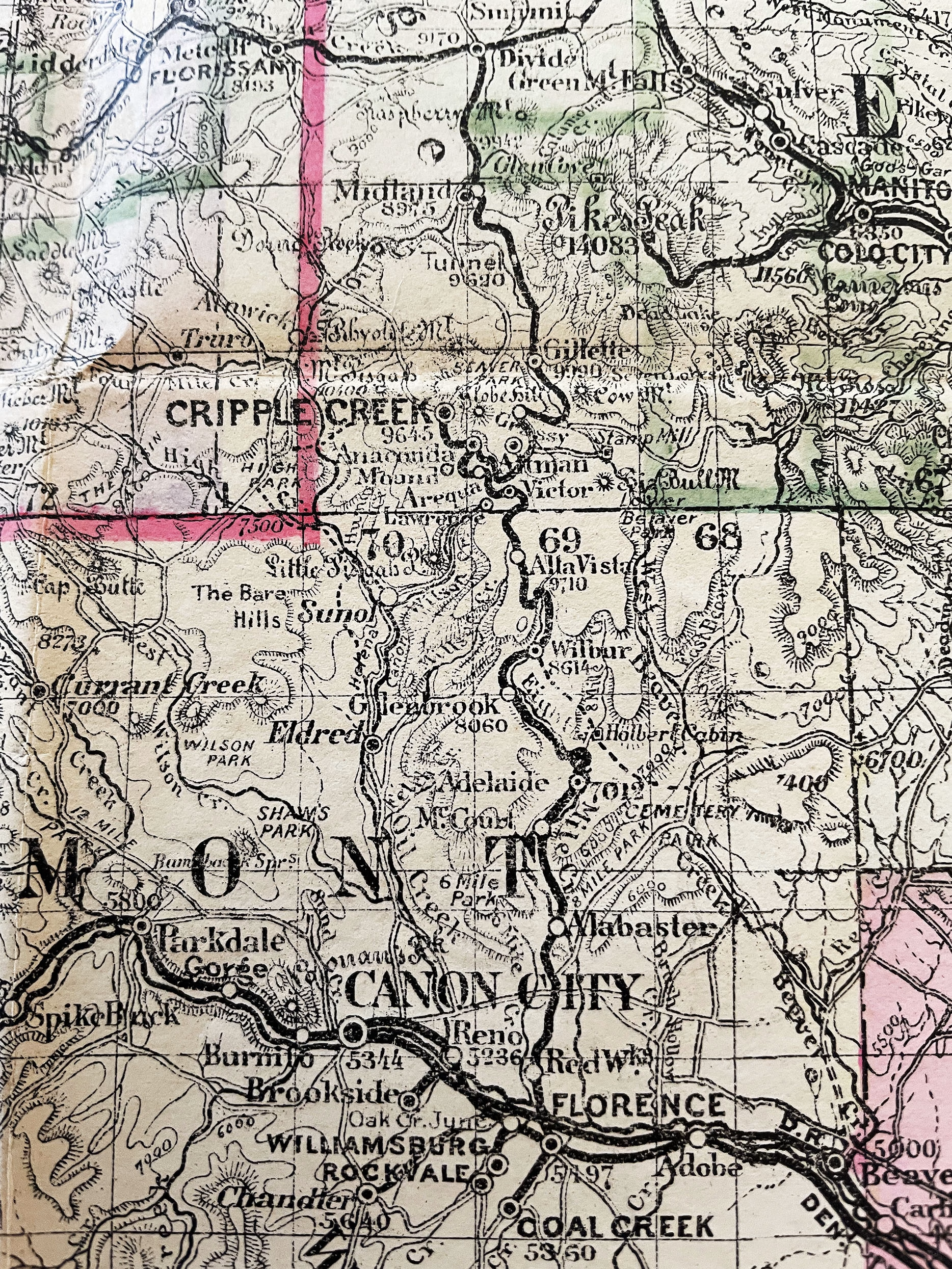
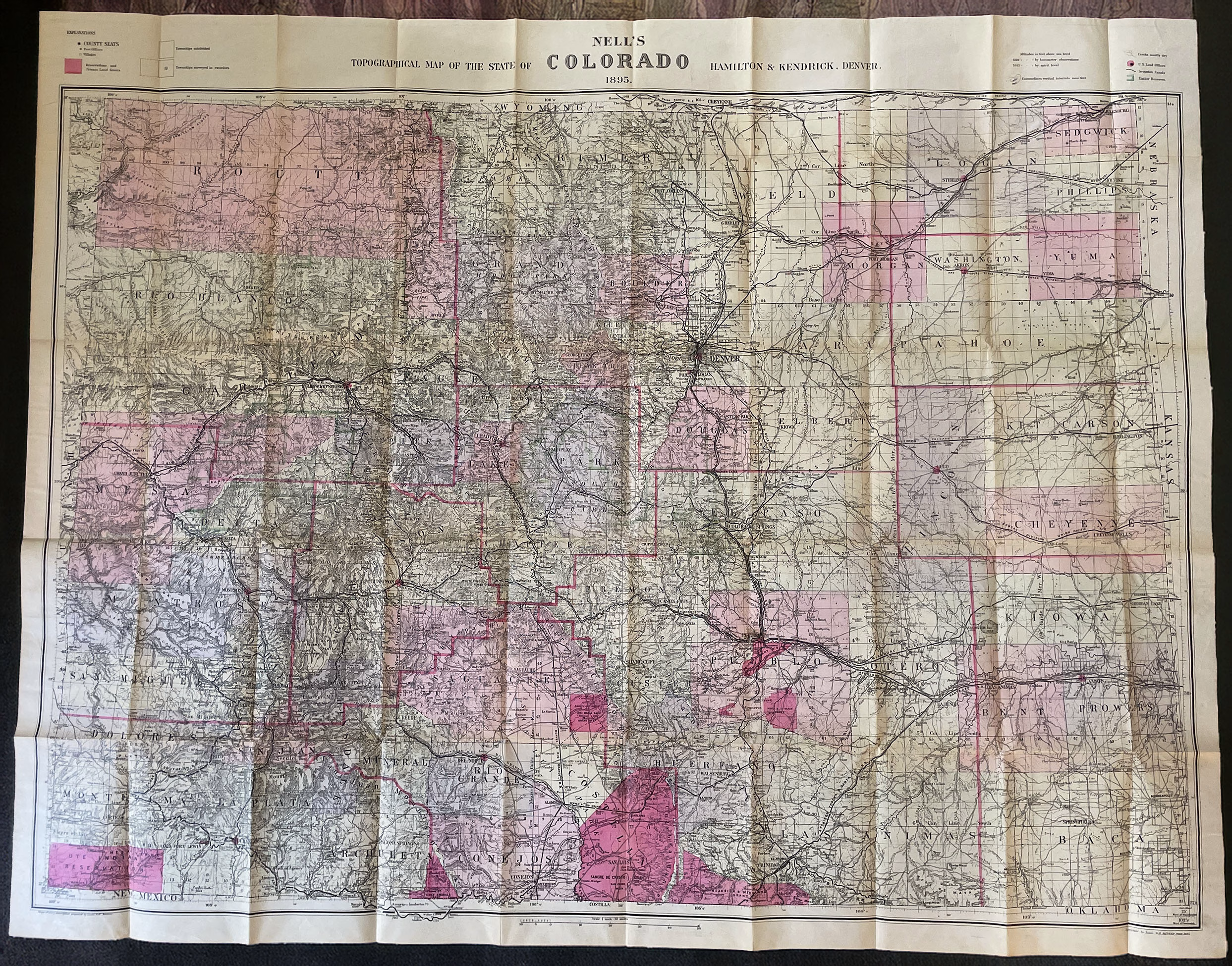
Description
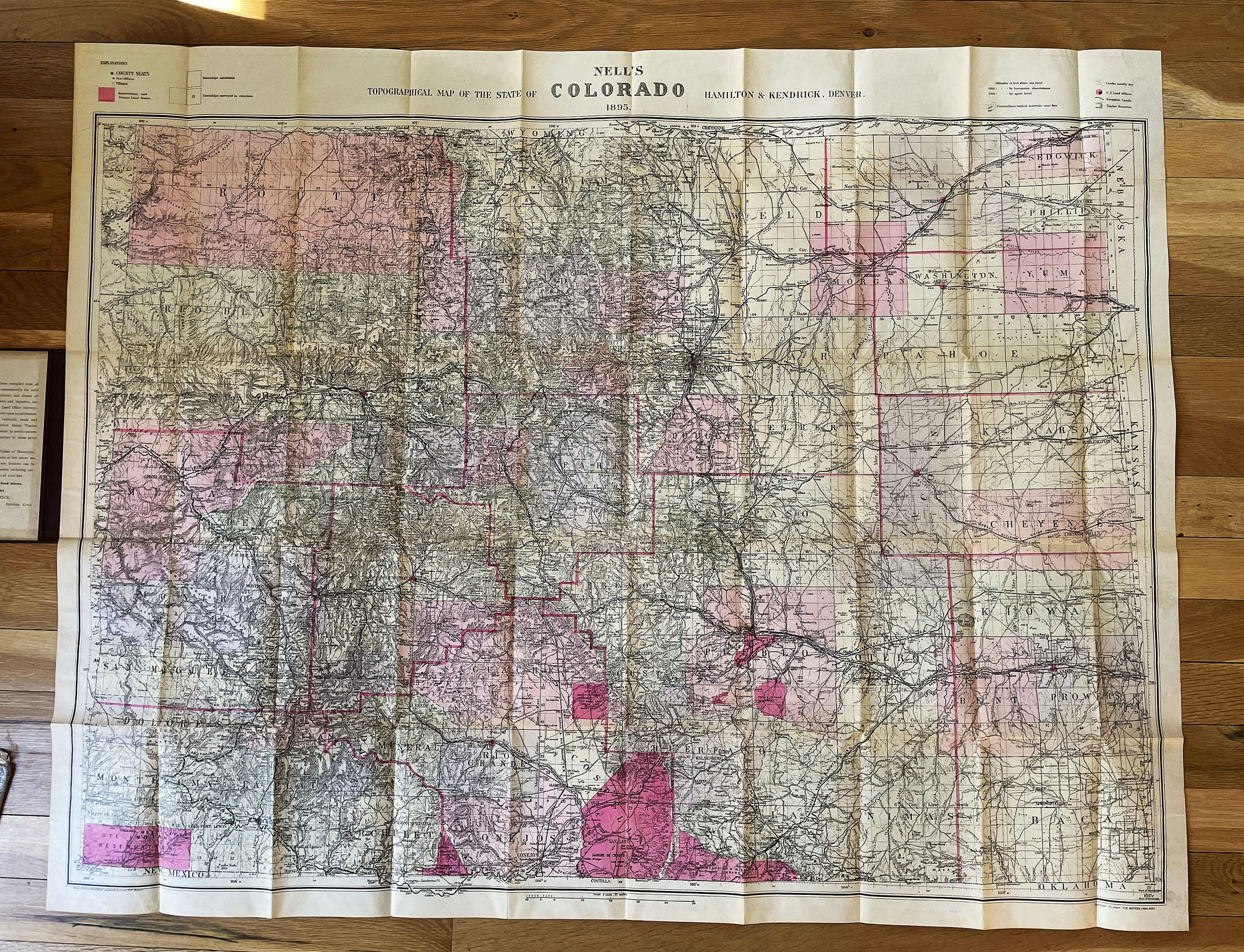
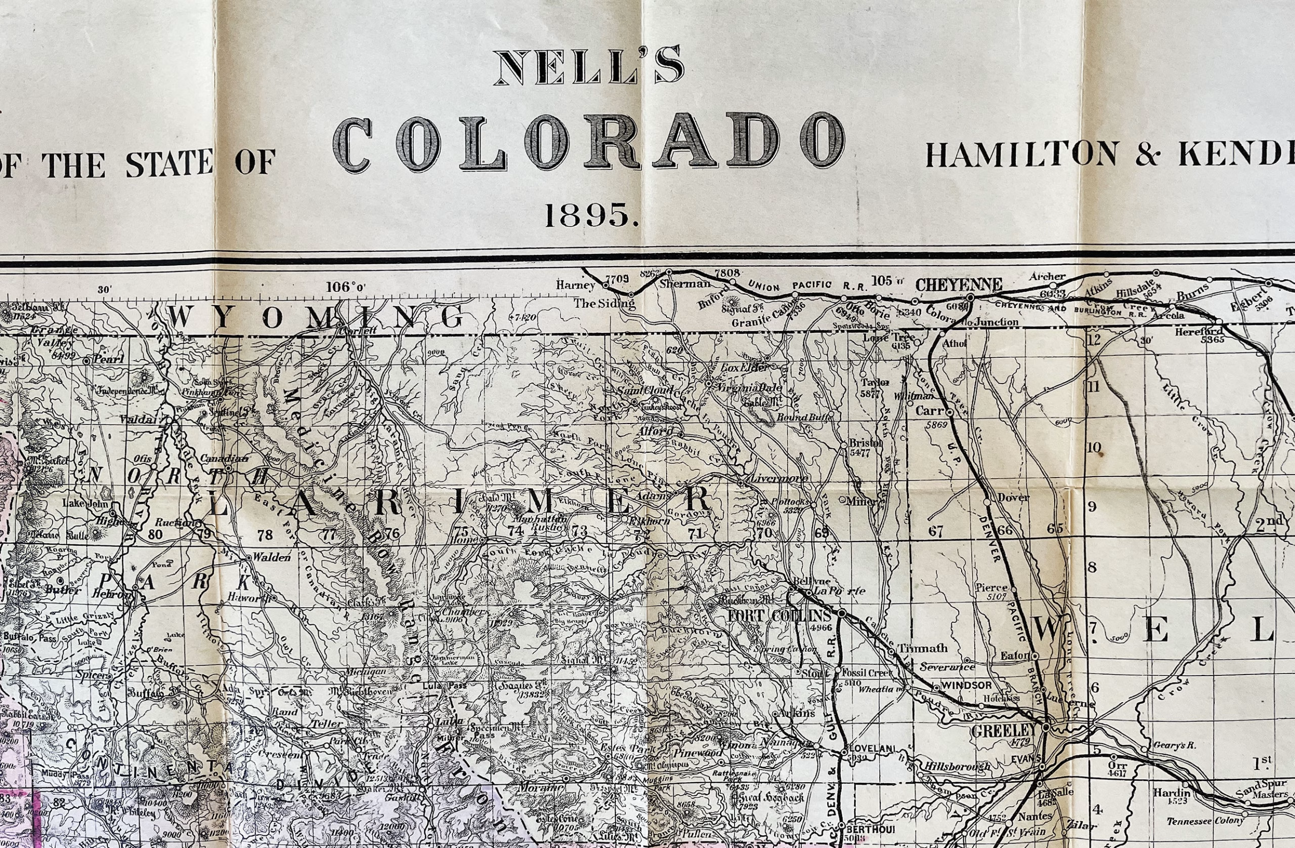
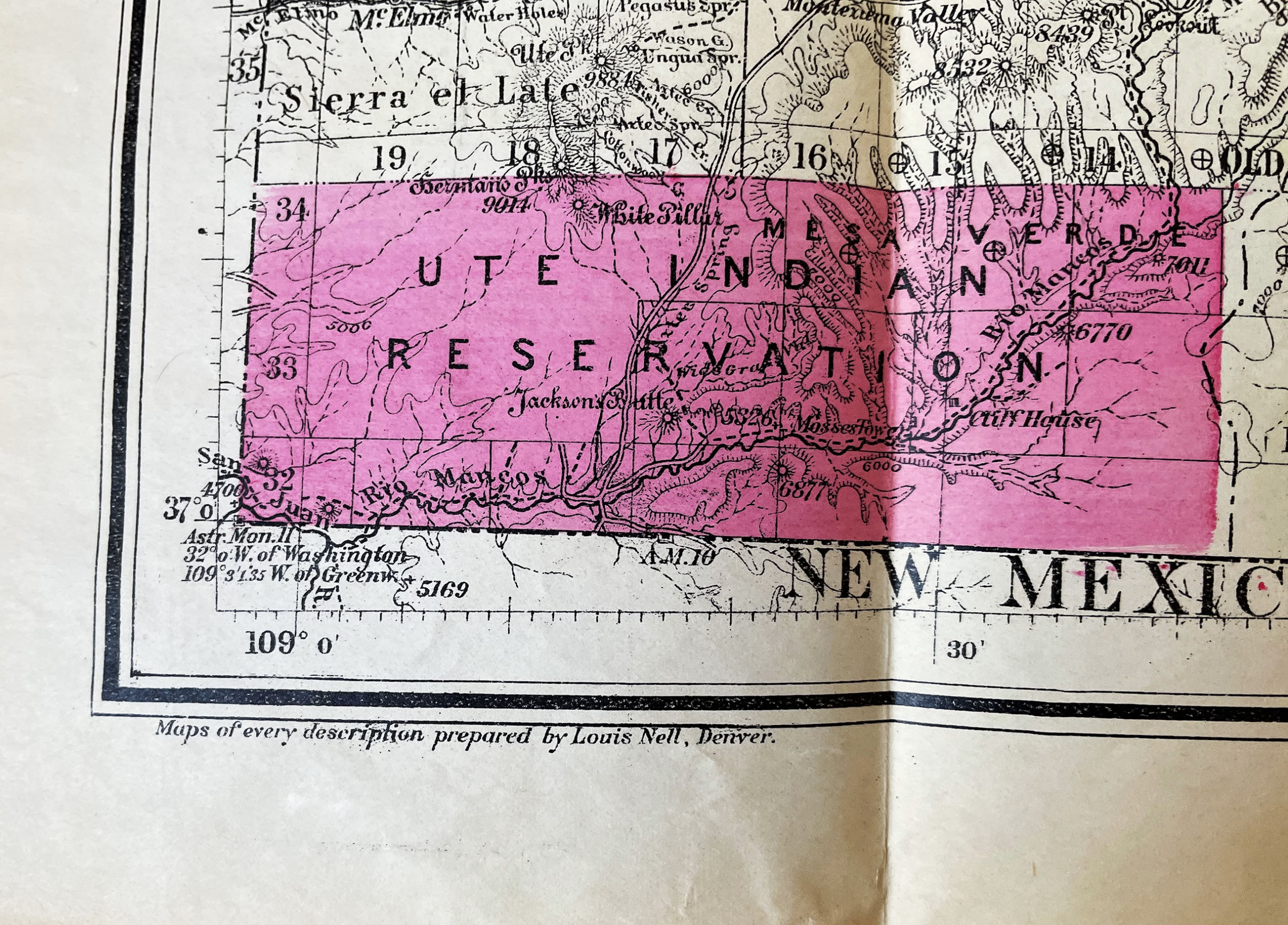
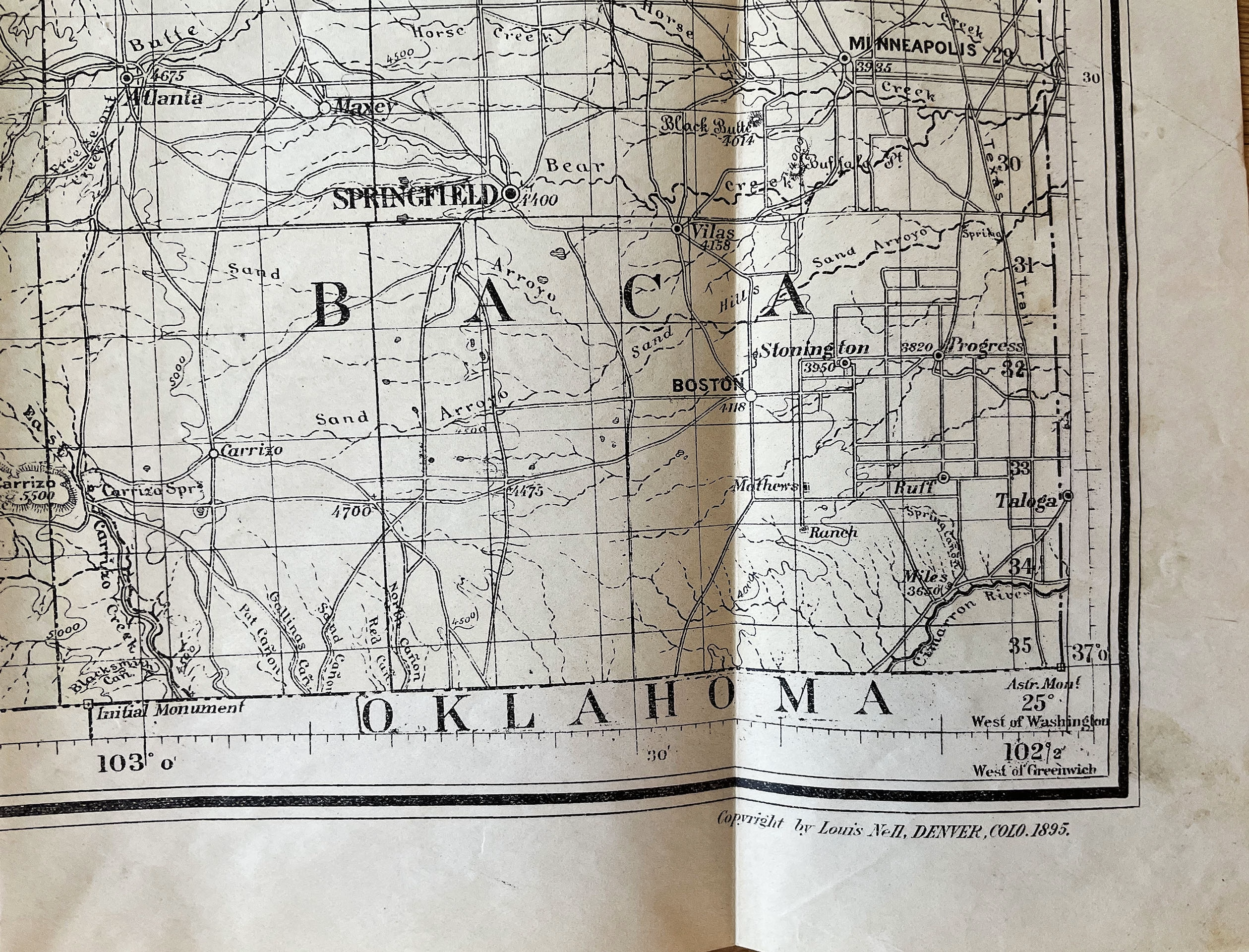
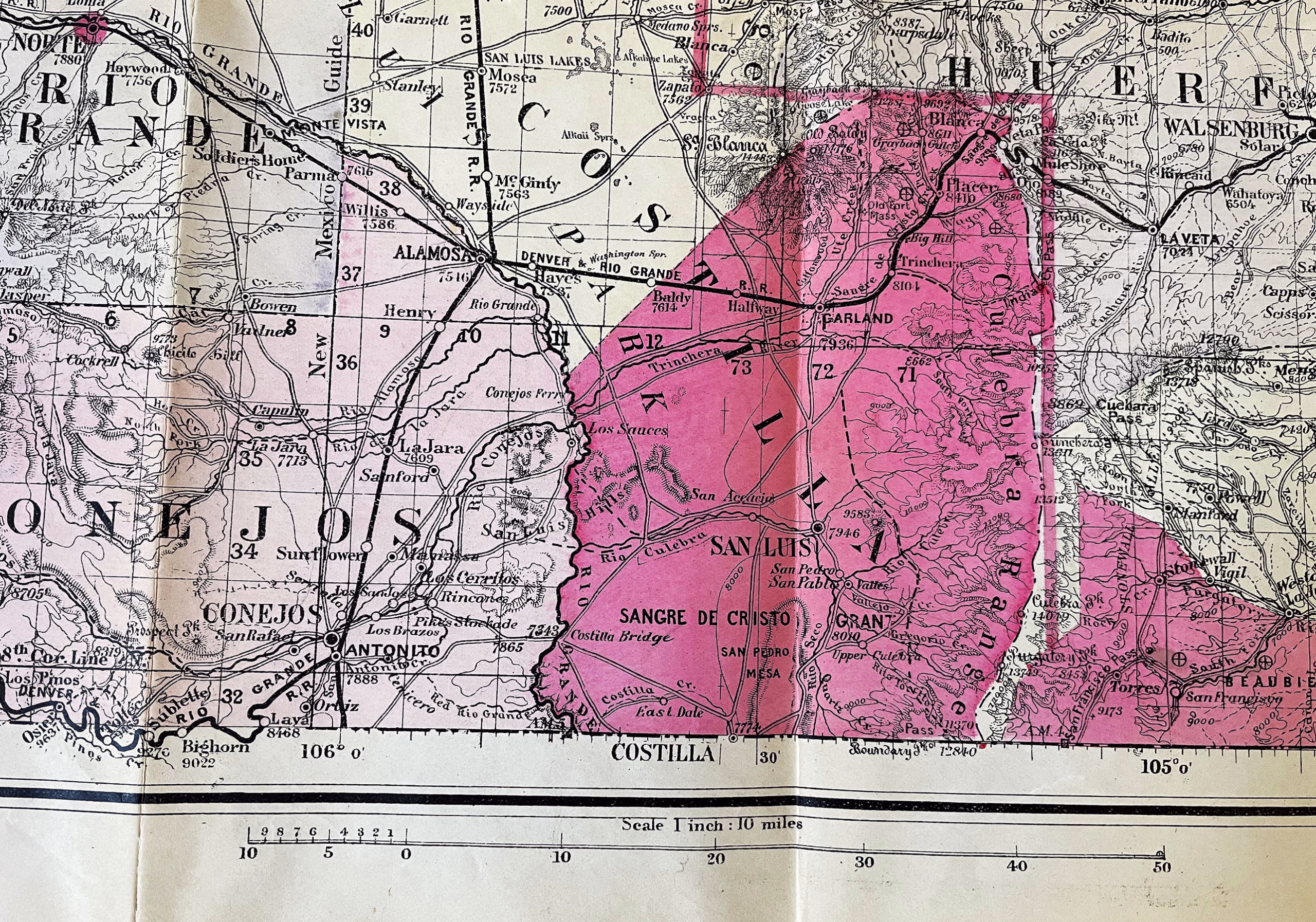
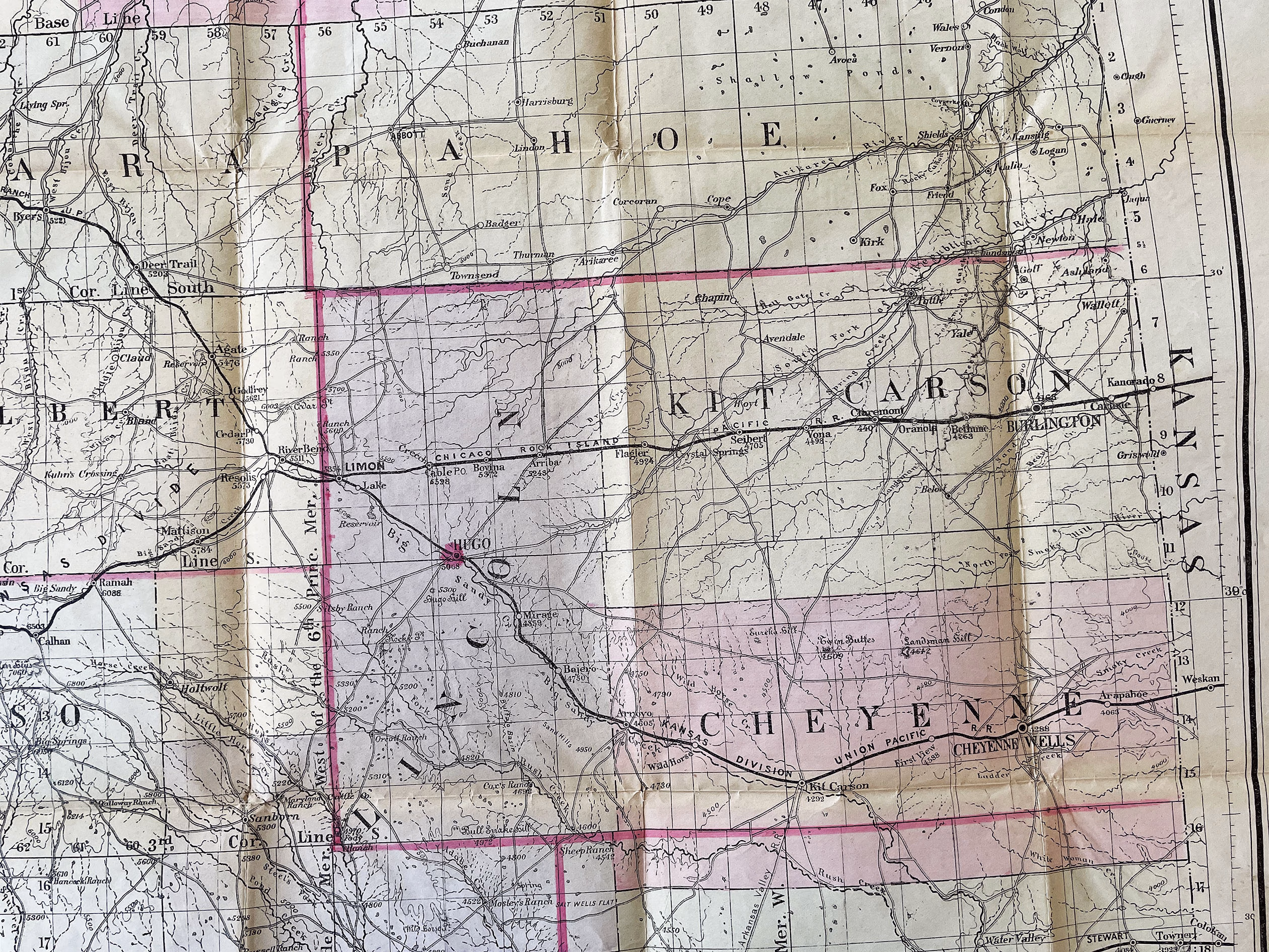
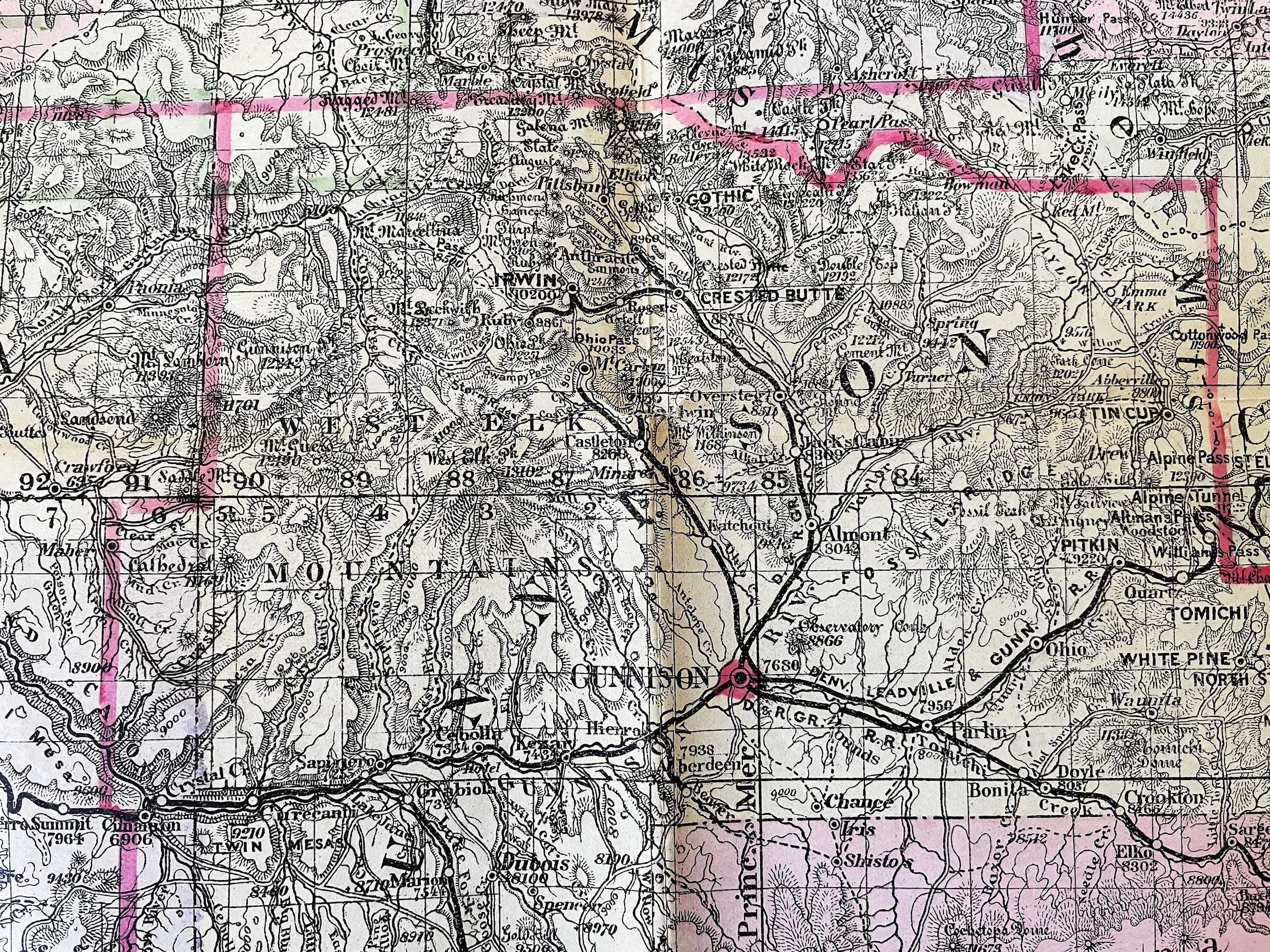
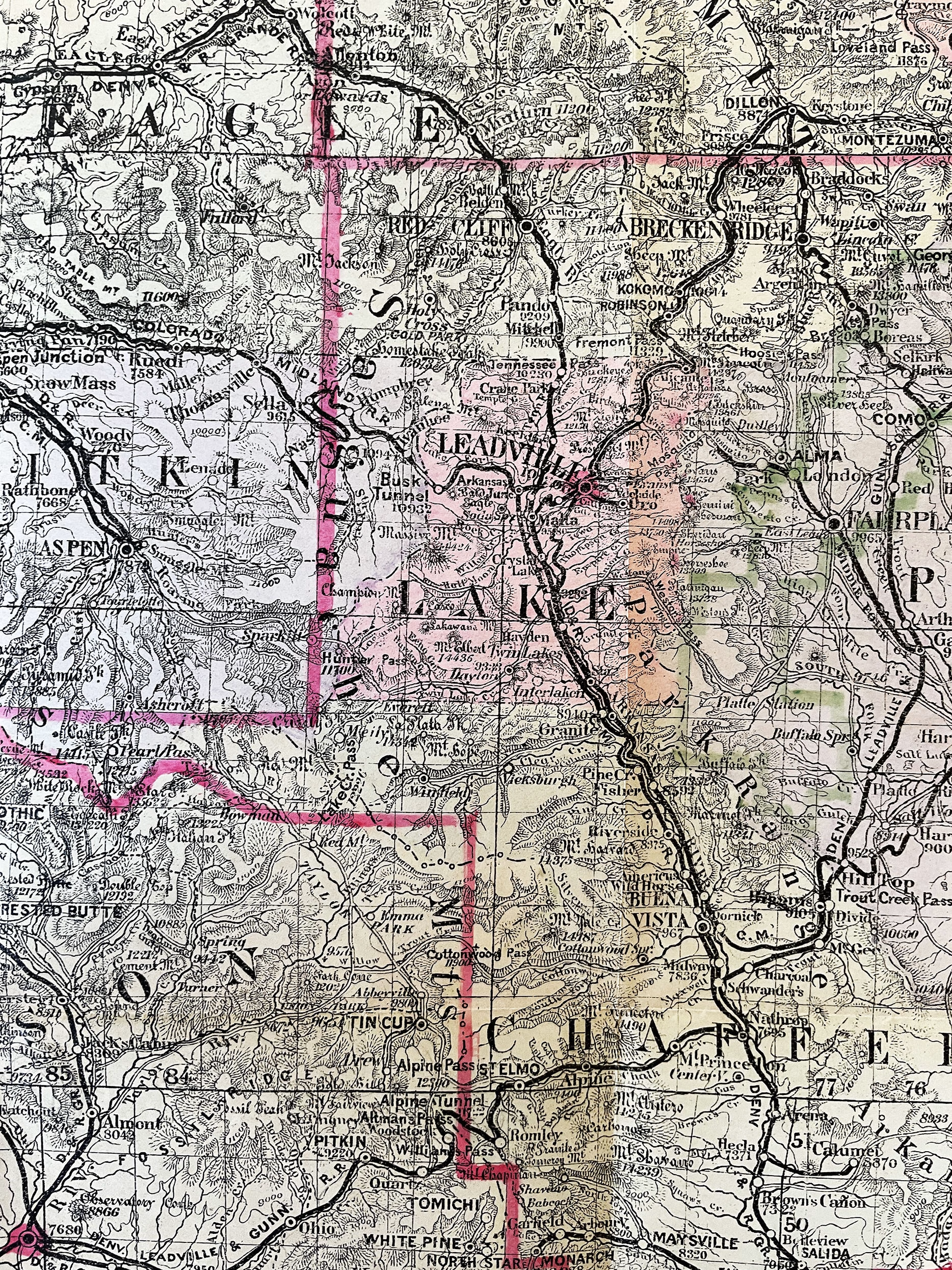
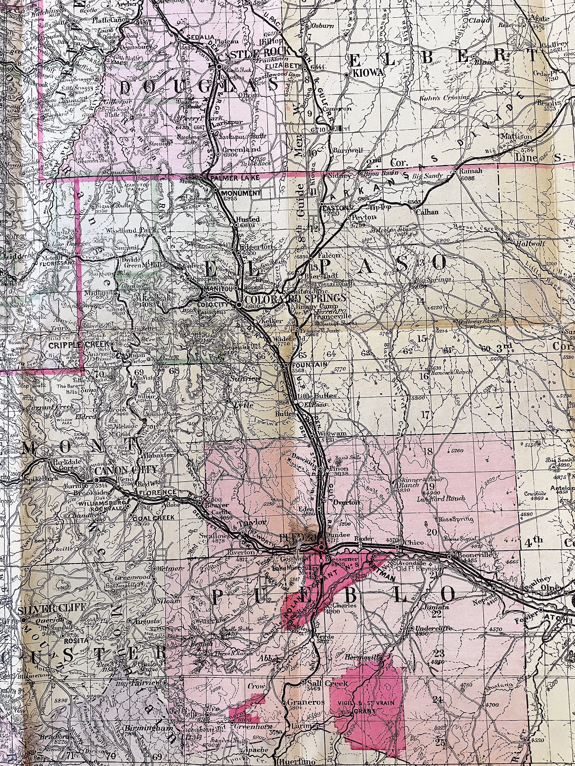
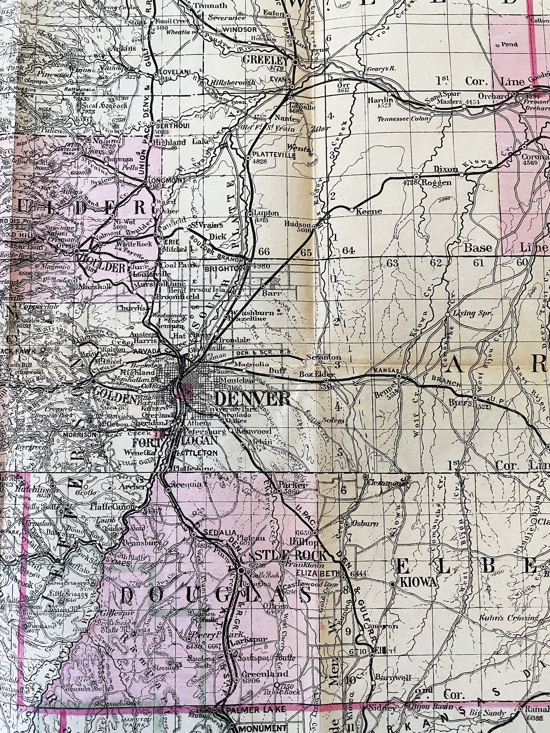
NELL’S TOPOGRAPHICAL MAP OF THE STATE OF COLORADO, 1895
Original Louis Nell’s Map of Colorado, published by Hamilton & Kendrick, Denver, Colorado
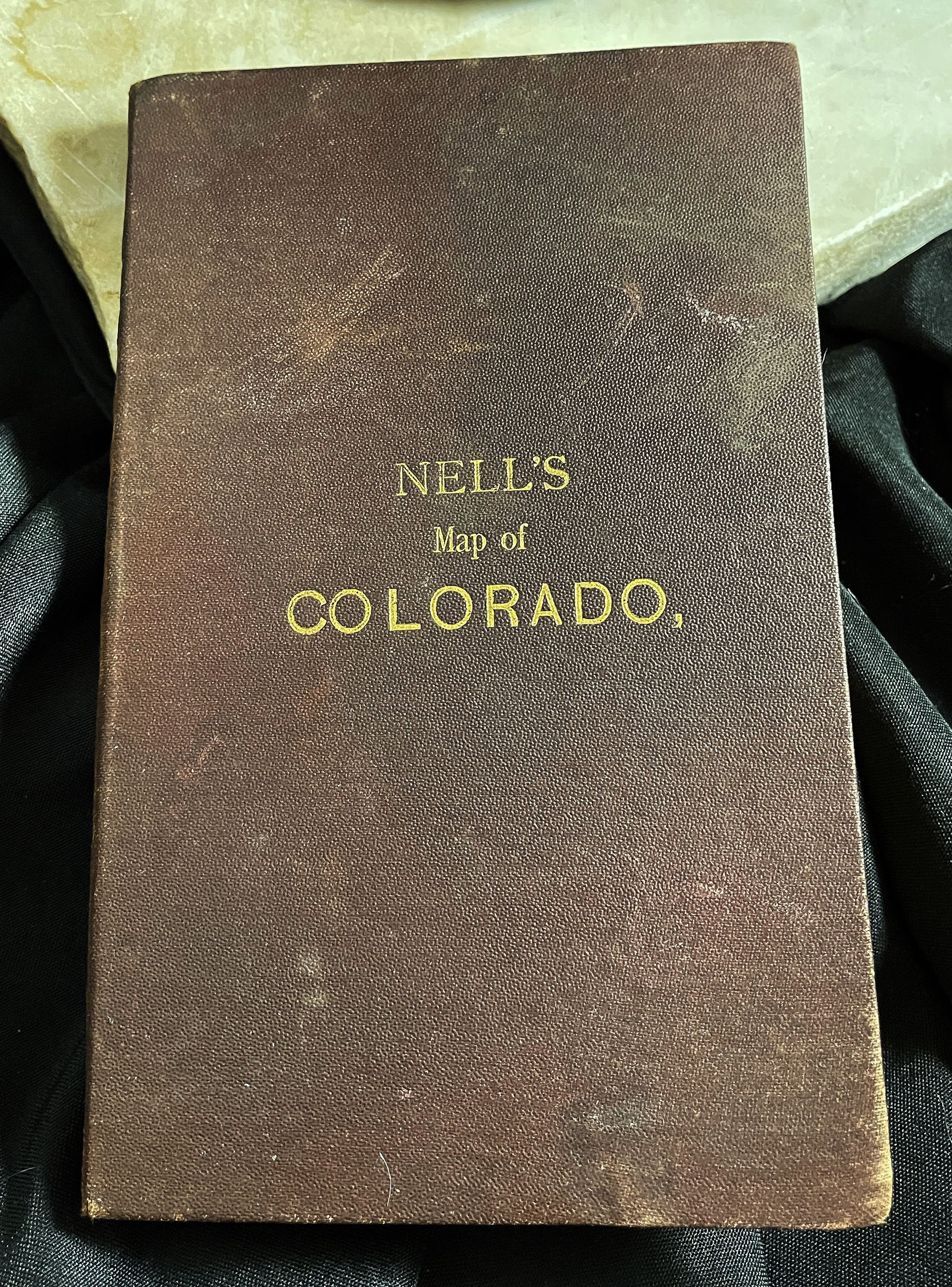
“Maps of Every Description Prepared by Louis Nell, Denver”
Copyright by Louis Nell, Denver, Colo., 1895
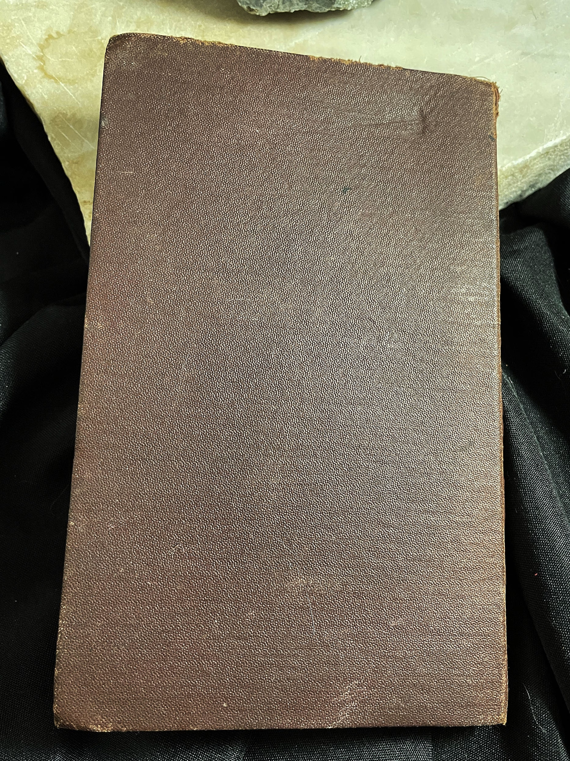
Map is contained in its original gold-printed, burgundy cloth covers.
Map folds out to the following dimensions: 41 inches in length by 34-1/4 inches in width.
Louis Nell was considered one of the most accurate and detailed cartographers of Colorado maps.
This 1895 Colorado exhibits, but is not limited to, the following details: townships, counties and county seats, post offices, villages, reservations and private land grants, altitudes, U.S. land offices, irrigation canals, timber reserves, creeks and rivers, lakes, railroads and roads, etc.
Covers are in very good plus condition.
Folding map is in very good plus condition, with light preservation work on back of map, especially at corner folds. One tiny bit of loss in the word, “Pueblo” barely noticeable on front of map.
Printed on thick bond paper. One section still attached to interior of cloth folder, as published.
Exceptionally accurate and up-to-date, to 1895.
COLORADO ARTIFACTUAL


