Description
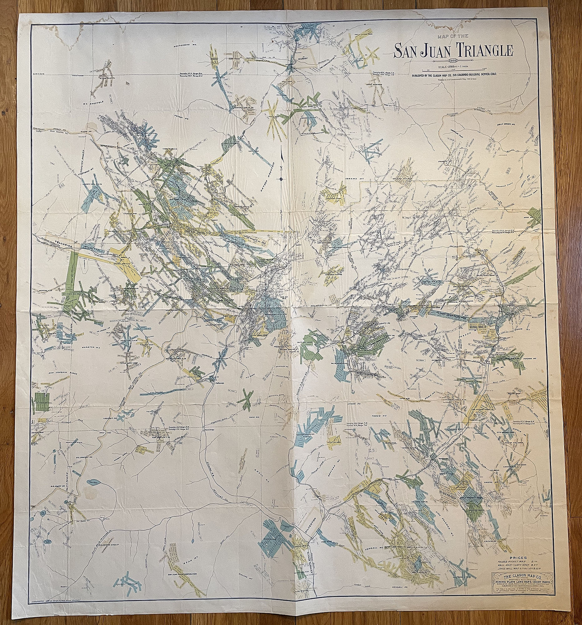
MAP OF THE SAN JUAN TRIANGLE, COLORADO, Dated: 1905
Published by The Clason Map Co., 316 Colorado Building, Denver, Colo.
Scale: 2500 ft = 1 inch
Original Clason map of mining districts and mining claims in southwestern Colorado.
Dimensions: 36 inches by 40 inches
Condition: very good plus; mounted on heavier-bond paper to strengthen map folds; some wrinkling in map from mount; some light dampstaining at top margin; otherwise, colors in mining claims are bright, strong, highly readable.
The Denver Lith. Co., Denver, Colorado
The Clason Map Co., Map Makers, Drafting & Blue Printing. Mining Plats, Land Maps, Court Maps, Birds Eye Views, Paintings of Mining Properties, Publishers of Colorado County & Mining District Maps
Copyrighted 1905 George S. Clason, Denver, Colorado
Mapped details of the following: Telluride Gold Mining District; Ouray Gold Mining District; Silverton Silver Mining District; Silverton Railroad; Silverton & Northern Railroad; Gladstone & Northerly Railroad; Rio Grande Southern Railroad & more
COLORADO ARTIFACTUAL