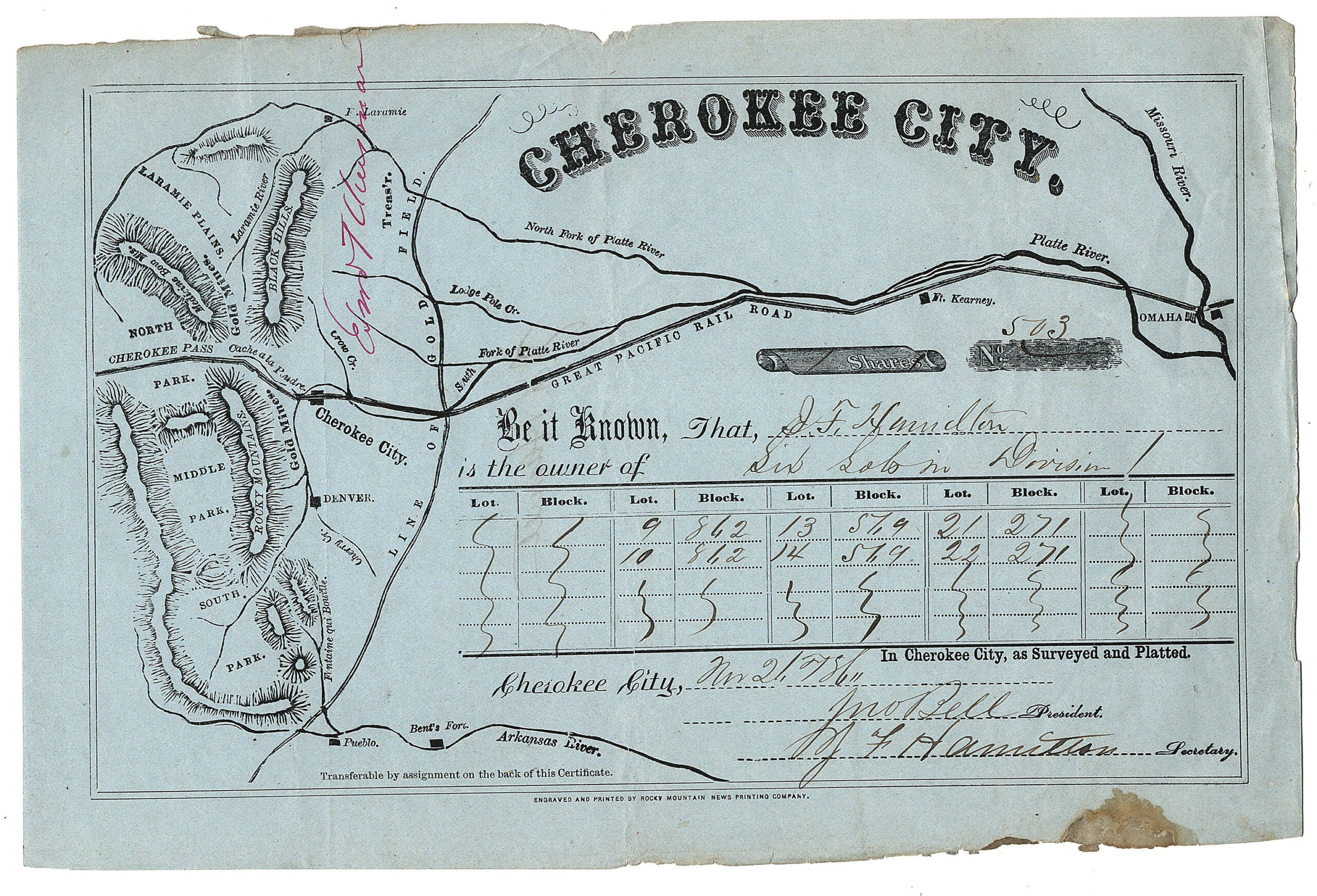

Description
ORIGINAL ANTIQUE COLORADO MAP
KANSAS TERRITORY – JEFFERSON TERRITORY – COLORADO TERRITORY
Map of the routes from Omaha, Nebraska to Cherokee City
Dated: November 21, 1860
THIS MAP IS CONSIDERED THE FIRST ENGRAVED AND PRINTED IN DENVER CITY, JEFFERSON TERRITORY (later, COLORADO TERRITORY).
Imprint in bottom margin, center: “ENGRAVED AND PRINTED BY ROCKY MOUNTAIN NEWS PRINTING COMPANY”*
*Established and operated by WILLIAM N. BYERS
Dimensions: 9-7/8 inches by 6-1/2 inches
Exceedingly scarce original antique map printed on a lot certificate for property in CHEROKEE CITY near the Cache a la Poudre River and east of the “Gold Mines” in North-, Middle-, and South Park, Jefferson Territory
Condition: very good plus to near fine; top & bottom edges a bit rough; small water stain — about an inch in length — on bottom margin. Original first printing in the Jefferson Territory of a map concerning topography in what would soon be the COLORADO TERRITORY.
“Great Pacific Railroad” also marked on map, projected from Omaha to Cherokee City, and through “Cherokee Pass.”
Not listed in McMurtrie & Allen’s EARLY PRINTING IN COLORADO, With a Bibliography of the Issues of the Press, 1859 to 1876, inclusive and a record and Bibliography of Colorado Territorial Newspapers. Hirschfeld Press, 1935
COLORADO ARTIFACTUAL


