
Description
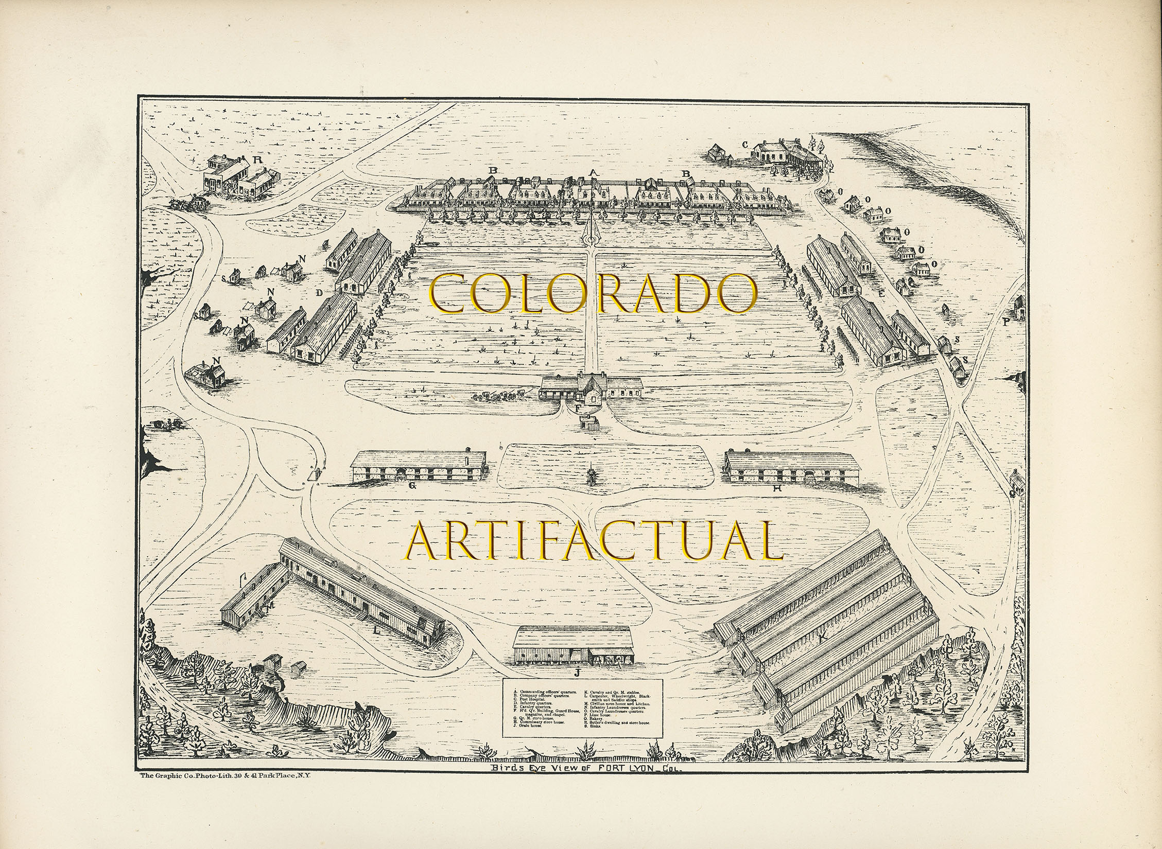
BIRD’S EYE VIEW OF FORT LYON, COLORADO TERRITORY, Circa 1868
Originally known as Bent’s Fort. Was renamed Fort Wise, after Henry A. Wise, Governor of Virginia. However, after the Civil War began, the fort was renamed again, in 1862, this time FORT LYON after Brigadier General Nathaniel Lyon, the first Union General killed in the Civil War.
Unfortunately, in 1864, Fort Lyon became the military headquarters for Col. John Chivington, who led an attack on Native Americans — Cheyenne and Arapaho (and mostly women and children) — who were generally friendly to the new settlers coming into the Colorado Territory. This harrowing and despicable event became known as the SAND CREEK MASSACRE.
In 1866, the Arkansas River flooded Fort Lyon and the surrounding area. Within a year,
Fort Lyon was rebuilt. Fort Lyon was located in Las Animas County, southeastern part
of the Colorado Territory.
Map dimensions: 11-1/2 inches by 8-3/4 inches
Printed by The Graphic Co. Photo-Lith., 30 & 41 Park Place, New York
Condition: near fine to fine; no significantwear or damage.
This single-sheet map may be from a government publication; however, I am currently unable to locate which one. Rare Colorado Territory military plan of Fort Lyon.
COLORADO ARTIFACTUAL


